

Overview
The Langtang Gosaikunda Trek is an extraordinary Himalayan journey that combines two of Nepal’s most spectacular destinations into one comprehensive adventure. This classic Langtang Gosaikunda trekking route takes you through the pristine Langtang Valley with its towering peaks and rich Tamang culture, then crosses high mountain passes to reach the sacred Gosaikunda Lakes—a pilgrimage site revered by both Hindus and Buddhists. The trek concludes by descending through traditional villages to Sundarijal, offering an incredibly diverse mountain experience.
This Gosaikunda Langtang trek showcases Nepal’s remarkable diversity—from subtropical forests filled with rhododendrons and wildlife to high-altitude alpine valleys dotted with yak herds, from ancient Buddhist monasteries to sacred Hindu pilgrimage lakes, and from the dramatic Langtang Valley surrounded by 7,000-meter peaks to the serene beauty of glacial lakes reflecting mountain panoramas. The journey spans approximately 120 kilometers through Langtang National Park, crossing the challenging Laurebina Pass (4,610m) and experiencing some of the most varied landscapes in the Himalayas.
The Langtang Valley Gosaikunda trek is perfect for trekkers seeking a comprehensive Himalayan experience combining culture, nature, and spirituality; adventurers wanting to explore beyond standard routes; pilgrims interested in sacred sites; nature enthusiasts seeking diverse ecosystems and wildlife; and experienced trekkers looking for moderate-to-challenging terrain with spectacular rewards. This trek offers the best of both worlds—the cultural richness and dramatic scenery of Langtang Valley combined with the spiritual significance and pristine beauty of the Gosaikunda Lakes, all within a manageable timeframe and with comfortable tea house accommodations.
Highlights
Itinerary
Your Langtang Gosaikunda adventure begins with an early morning departure from Kathmandu. After breakfast at your hotel around 6:00-6:30 AM, you'll be picked up for the scenic drive to Syabrubesi, the traditional starting point for Langtang Valley treks. The journey covers approximately 117 kilometers and takes 7-8 hours, but the spectacular mountain scenery makes the time pass enjoyably.
The drive follows the Pasang Lhamu Highway, initially traveling through the Kathmandu Valley before climbing into the middle hills. You'll pass through bustling market towns, terraced farmland cascading down hillsides, and traditional Nepali villages offering fascinating glimpses of rural life. The road follows the churning Trishuli River, one of Nepal's major rivers used for whitewater rafting, with the rushing water providing constant accompaniment.
Stop at Trishuli Bazaar (approximately 3 hours from Kathmandu) for a lunch break at a local restaurant. After refueling, continue the journey through increasingly mountainous terrain. The road winds through dramatic gorges, crosses tributaries on suspension bridges, and climbs through forested ridges. As you approach the Langtang region, glimpses of snow-capped peaks begin appearing through the valleys.
The final section passes through increasingly alpine landscapes with pine forests and scattered settlements. Arrive at Syabrubesi by mid-to-late afternoon—a frontier town at the confluence of the Bhote Koshi and Langtang rivers, serving as the gateway to Langtang Valley and the Tamang Heritage Trail. The town has grown since the 2015 earthquake, with improved infrastructure and numerous lodges.
Check into your tea house—comfortable accommodations offering clean twin-bedded rooms, shared or attached bathrooms, and warm communal dining areas. After settling in, explore the village, enjoy mountain views, and meet your trekking guide for a comprehensive briefing about the trek ahead. Your guide will discuss the itinerary, answer questions, check equipment, and ensure you're prepared for the journey.
Dinner features traditional Dal Bhat (rice and lentil curry—the staple Nepali meal that provides excellent trekking energy) or other Nepali and international dishes. Rest well tonight as your trekking adventure begins tomorrow morning.
Drive Time: 7-8 hours
Altitude: 1,460m
Accommodation: Tea house in Syabrubesi
Meals: Breakfast, lunch, dinner
After an early breakfast around 7:00 AM, begin your Langtang Gosaikunda trek with the journey into Langtang Valley. The trail descends from Syabrubesi to cross a suspension bridge over the Bhote Koshi River, then begins climbing steadily into magnificent subtropical and temperate forests.
The initial hours follow the Langtang Khola (river), which will accompany you for much of the Langtang Valley section. The trail ascends through dense forests of oak, maple, bamboo, and rhododendron—particularly spectacular during spring (March-May) when rhododendrons bloom in brilliant reds, pinks, and whites, creating entire hillsides of color. The forest ecosystem is rich with biodiversity.
Watch for wildlife throughout the day: langur monkeys are commonly seen swinging through the forest canopy, often in large troops; colorful bird species including the Danphe pheasant (Nepal's national bird); and with luck, glimpses of red pandas in bamboo groves (though these are shy and rare). Your guide points out medicinal plants used in traditional medicine, explains forest ecology, and shares stories about local wildlife.
The path crosses several streams on wooden and suspension bridges, each offering rest opportunities and photo spots. The trail alternates between steeper sections with stone steps and gentler gradients, with the overall elevation gain being steady but very manageable. As you climb higher, the forest composition changes with more conifers appearing, and the temperature gradually cooling.
Around midday, reach Bamboo village (1,960m)—a small settlement of tea houses named for the surrounding dense bamboo forests. This makes an excellent lunch stop where you can refuel with hot meals like fried rice, noodle soup, or Tibetan momos (dumplings) while resting on benches outside the lodges.
After lunch, continue ascending through increasingly magnificent forest draped with moss, lichens, and hanging plants, creating an enchanted, primeval atmosphere. The afternoon brings you through pristine forest with the sounds of the river and birds providing natural soundtrack. The trail gains elevation steadily but comfortably.
Arrive at Lama Hotel (2,380m) by late afternoon—despite the name, this is a village area with several tea houses, not a single hotel. The forest setting is beautiful and peaceful, with the rushing Langtang Khola nearby. Check into your lodge, typically offering comfortable rooms with twin beds, shared bathrooms (some lodges have attached), and cozy dining rooms with wood-burning stoves that become the evening gathering place.
After settling in, enjoy hot tea or coffee while warming by the stove. The evening is relaxed, with time to meet fellow trekkers, enjoy dinner, and rest. The forest location means early darkness and cooler temperatures—the warm dining room and hearty food create perfect comfort after your first day's trekking.
Trekking Time: 5-6 hours
Altitude Gain: 920 meters
Accommodation: Tea house at Lama Hotel
Meals: Breakfast, lunch, dinner
Trail Highlights: Subtropical forest, wildlife, bamboo groves, river crossings
After breakfast, continue your ascent deeper into the Langtang Valley. The morning begins with further climbing through beautiful temperate forests that gradually transition from dense woodland to more open terrain. The forest composition changes with altitude—rhododendrons remain prominent, joined by hemlock and other conifers, with the trees becoming shorter and more twisted as you gain elevation.
The trail is well-maintained with stone steps in steeper sections, making the climb comfortable despite the significant elevation gain. Cross several tributary streams on wooden bridges, pass through occasional forest clearings offering glimpses of peaks through the trees, and continue steadily upward. The forest eventually begins thinning, allowing better views of the surrounding ridges.
Around mid-morning, reach Ghoda Tabela (3,020m), meaning "horse stable" in Nepali. This area served as a Tibetan refugee settlement in the past and functioned as grazing grounds. Now it's a small collection of tea houses serving as a popular rest stop. The settlement marks a significant transition point—take a break here for hot drinks or snacks before the valley's dramatic opening.
After Ghoda Tabela, the landscape transforms spectacularly. The dense forest gives way to more open terrain with scattered juniper bushes, alpine shrubs, and rocky outcrops. Suddenly, the Langtang Valley reveals itself in its full glory—a wide, glaciated U-shaped valley surrounded by soaring Himalayan peaks creating one of the most dramatic mountain amphitheaters in Nepal.
Langtang Lirung (7,227m), the highest peak in the Langtang region, dominates the view ahead with its massive glaciated north face rising over 5,000 vertical meters from the valley floor—an overwhelming, awe-inspiring sight. Other peaks including Ganesh Himal, Dorje Lakpa, Langtang Ri, and countless others create a spectacular 360-degree panorama of snow-capped summits.
The trail continues through increasingly alpine landscape characterized by traditional stone walls (built to protect fields from yaks and wildlife), Buddhist chortens (stupas/shrines), and mani walls (long stone walls carved with Buddhist prayers and mantras). These cultural markers indicate you're entering the heart of Tamang Buddhist territory. Prayer flags flutter everywhere, carrying blessings on the mountain wind.
Pass through several small settlements with yak pastures and potato fields (in season) before reaching Langtang Village (3,430m), the largest settlement in the upper valley. This traditional Tamang village was tragically destroyed by a massive avalanche during the April 2015 earthquake, killing hundreds of residents and visitors. The community has shown extraordinary resilience, completely rebuilding the village with improved earthquake-resistant infrastructure while maintaining traditional Tamang architectural style and cultural heritage.
The rebuilt village features well-constructed lodges, a health post, monastery, school, and community buildings. Check into your tea house—the rebuilt lodges offer comfortable accommodations with the famous Langtang hospitality. Many lodge owners are survivors who lost family members, and their strength and warmth despite unimaginable tragedy is deeply moving.
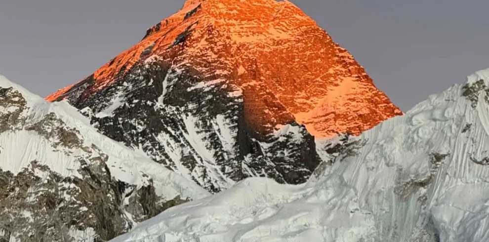
The afternoon offers time to explore the village, visit the local monastery with its prayer wheels and murals, interact respectfully with Tamang residents and learn about their culture, or simply rest and acclimatize while enjoying spectacular mountain views. As evening approaches, watch the sunset illuminate Langtang Lirung and surrounding peaks in golden-orange light—some of the most photogenic moments of any Himalayan trek.
Dinner in the warm dining room features hearty meals with extensive menus. The communal atmosphere brings trekkers and locals together, sharing stories and warmth around the wood stove.
Trekking Time: 5-6 hours
Altitude Gain: 1,050 meters
Accommodation: Tea house in Langtang Village
Meals: Breakfast, lunch, dinner
Trail Highlights: Valley opening, Langtang Lirung views, Tamang culture, rebuilt village
Today's trek is shorter but exceptionally scenic as you approach the spiritual heart of the upper Langtang Valley. After breakfast, begin trekking through quintessential high-altitude Himalayan landscape—wide open valleys, stone walls crisscrossing yak pastures, prayer flags streaming in the wind, and towering peaks in every direction creating overwhelming mountain panoramas.
The trail is relatively gentle with gradual elevation gain, allowing you to fully appreciate the spectacular surroundings. The path winds through extensive yak pastures where you'll encounter herds of these magnificent adapted animals grazing peacefully. Yaks (and yak-cow hybrids called dzos/naks) are essential to high-altitude Himalayan life, providing milk, meat, wool, transportation, and fuel (dried dung). Watch for yak herders tending their animals—opportunities for interaction and photography.
The landscape is quintessentially high Himalayan—sparse alpine vegetation consisting of hardy grasses and low shrubs, glacial streams crossed on wooden bridges, rocky moraine terrain, and constant breathtaking mountain views. Langtang Lirung continues dominating the western view with its massive glaciated face, while Langshisa Ri, Dorje Lakpa, Ganjala Peak, Yala Peak, and numerous others create a spectacular amphitheater. Looking back down the valley offers perspectives of the route you've ascended.
The trail passes several cheese factories (yak cheese production facilities)—small stone buildings where locals produce cheese from yak milk using traditional methods introduced by Swiss development projects decades ago. You can stop to observe the cheese-making process, taste fresh yak cheese (which has a distinctive sharp flavor), purchase cheese or yogurt, and support local livelihoods. These facilities provide valuable income for communities.
Continue through this magnificent landscape, the trail marked by countless prayer flags, mani walls, and chortens. The increasing density of Buddhist symbols indicates the approaching sacred site of Kyanjin Gompa. The air is thin at this altitude—move slowly, breathe deeply, and appreciate every step through this extraordinary environment.
Arrive at Kyanjin Gompa (3,870m) by late morning or early afternoon—a small settlement of lodges and homes centered around an ancient Buddhist monastery, representing the spiritual heart of the upper Langtang Valley. This is the highest permanent settlement in the valley and serves as your base for acclimatization and exploration activities tomorrow.
Check into your lodge—tea houses here offer basic but comfortable accommodations with spectacular mountain-view windows, heated dining rooms with wood stoves, and simple but adequate facilities. Despite the remote location and altitude, the hospitality is warm and the food surprisingly varied and delicious.
After settling in, the afternoon offers several excellent activities:
Kyanjin Gompa Monastery Visit: Explore the ancient monastery featuring beautiful Buddhist murals depicting deities and mandalas, statues of Buddha and bodhisattvas, prayer wheels, and religious artifacts. The monastery is an active spiritual center where monks (though fewer now than before the earthquake) practice Buddhism and maintain traditions. If timing aligns with prayer ceremonies, you may observe or respectfully participate. The peaceful atmosphere with mountain backdrop creates a profoundly moving spiritual experience.
Cheese Factory Visit: Walk to the nearby yak cheese factory to observe traditional cheese-making. The process involves collecting yak milk, heating and curdling it, pressing it into molds, and aging. You can taste and purchase various yak cheese products while supporting the local economy.
Short Acclimatization Walk: Take gentle walks around the valley to aid acclimatization for tomorrow's high-altitude exploration. Even 30-45 minutes of walking at this elevation helps your body adjust while offering different perspectives and photo opportunities.
Rest and Photography: Simply relax in the warm dining room with hot tea, journal about your experiences, or photograph the incredible scenery as afternoon light transforms the peaks through various moods and colors.
As evening approaches, watch the spectacular sunset paint Langtang Lirung and neighboring mountains in brilliant shades of gold, pink, and orange—the golden hour here is magical. Dinner features hearty, high-energy meals designed for altitude performance. Rest well tonight in preparation for tomorrow's exploration day.
Trekking Time: 3-4 hours
Altitude Gain: 440 meters
Accommodation: Tea house at Kyanjin Gompa
Meals: Breakfast, lunch, dinner
Trail Highlights: Yak pastures, cheese factory, monastery, spectacular mountain amphitheater
Today is dedicated to high-altitude exploration around Kyanjin Gompa, with options depending on your fitness, acclimatization, and ambition. This acclimatization day is crucial for your body to adjust before crossing Laurebina Pass in a few days.
Option 1 - Kyanjin Ri (4,773m) - RECOMMENDED:
The most popular option is climbing Kyanjin Ri, a peak directly behind Kyanjin Gompa offering extraordinary panoramic views for a manageable climb. Wake around 5:00-5:30 AM for an early start to reach the summit for sunrise—one of the most spectacular experiences in the Langtang region.
The trail begins behind the lodges, initially climbing gently through rocky terrain before steepening considerably as you ascend the ridge. The path is clear and well-marked with occasional cairns and prayer flags, but the climb is sustained and challenging at this altitude. The thin air makes breathing difficult—maintain a slow, steady pace with frequent rest breaks (every 10-15 minutes) to avoid exhaustion.
As you climb higher through the pre-dawn darkness (headlamp essential), the sky gradually lightens. The views become increasingly spectacular with every vertical meter gained—the entire Langtang range slowly revealing itself in the growing light. The final section to the summit involves scrambling over rocky terrain to reach the prayer flag-draped summit cairn.
Reaching the summit of Kyanjin Ri at 4,773 meters as the sun rises over the Himalayas is an absolutely unforgettable experience. The 360-degree panorama is simply breathtaking:
- Langtang Lirung (7,227m): The dominant peak with its massive glaciated north face
- Shishapangma (8,027m): The 14th highest mountain in the world (8,000m+), visible to the north in Tibet on clear days
- Ganesh Himal: A stunning range to the south
- Langtang II, Dorje Lakpa, Langshisa Ri, Ganjala Peak, Yala Peak: And countless other peaks
- Langtang Glacier: Visible snaking through the upper valley
- The entire valley: Stretching toward Tibet, with your trekking route visible below
The sunrise transforms the peaks from dark silhouettes to glowing golden mountains painted in brilliant shades of orange, pink, and gold. Your guide provides detailed mountain identification while you capture photographs and simply absorb this extraordinary panorama. Many trekkers describe this summit as the highlight of their entire Nepal journey.
After spending 30-45 minutes on the summit enjoying the views, begin the descent back to Kyanjin Gompa (2-3 hours). The descent offers completely different perspectives and excellent photo opportunities in full daylight. Total round-trip time: 5-6 hours.
Option 2 - Tserko Ri (4,984m):
For very fit and well-acclimatized trekkers, Tserko Ri offers an even higher viewpoint with slightly more extensive panoramas. The climb takes 6-7 hours round trip and is more demanding, but the additional height provides stunning perspectives. This option is only recommended if you're feeling strong and showing no altitude issues.
Option 3 - Langshisa Kharka (4,285m):
Trek further up the Langtang Valley toward the Tibetan border to Langshisa Kharka, beautiful high-altitude meadows offering stunning close-up views of the Langshisa Glacier and surrounding peaks. This 5-6 hour round-trip trek follows the valley floor, making it less altitude-demanding than summit climbs while still providing spectacular scenery and excellent acclimatization.
Option 4 - Rest Day:
If you're feeling altitude effects or prefer a relaxed day, spend the day at Kyanjin Gompa. Take short walks, visit the monastery again, explore the cheese factory, interact with locals, read, journal, or simply rest. Proper acclimatization sometimes means resting rather than pushing higher.
After your morning exploration, return to Kyanjin Gompa for lunch. The afternoon is free to rest, organize and repack gear for the transition toward Gosaikunda (you'll be leaving Langtang Valley tomorrow), or take additional short walks. Evening includes a hearty dinner celebrating your achievements and preparing for tomorrow's journey toward the sacred lakes.
Activity Time: 4-7 hours depending on chosen activity
Maximum Altitude: 4,773m (Kyanjin Ri), 4,984m (Tserko Ri), or 4,285m (Langshisa Kharka)
Accommodation: Tea house at Kyanjin Gompa
Meals: Breakfast, lunch, dinner
Highlight: Summit sunrise with spectacular Himalayan panoramas
After breakfast and a final appreciation of the spectacular Kyanjin setting with morning mountain views, begin your return descent down the Langtang Valley. Today's long trekking day retraces the route you took two days to ascend, but the descent is relatively comfortable despite covering significant distance.
The return journey offers completely different perspectives on the familiar landscape—what you saw looking up now appears looking down, with different lighting (morning vs. previous afternoon) creating new photographic opportunities and changed moods. You'll appreciate how far you've come and how dramatically the landscape transforms with altitude.
Retrace your route through the upper valley's yak pastures and alpine terrain, with constant spectacular mountain views behind you as you descend. The peaks you've become familiar with—Langtang Lirung, Langshisa Ri, Dorje Lakpa—now appear from different angles and in different light. Pass through Langtang Village where you can stop for mid-morning tea or early lunch, perhaps visiting any parts of the rebuilt village you missed earlier or purchasing handicrafts to support the community.
Continue descending through the valley as it gradually narrows and the landscape transitions from alpine meadows back to forested zones. The trail passes through Ghoda Tabela before re-entering the magnificent rhododendron and oak forests of the mid-elevation zone. The lower altitude makes breathing noticeably easier, and you'll feel more energetic and strong despite the long walking day—a clear indication of how well your body has acclimatized.
The afternoon involves descending through the beautiful forests you trekked through on Day 2 and Day 3, crossing familiar streams and bridges, passing through Bamboo village, and eventually arriving back at Lama Hotel by late afternoon or early evening. The familiar lodge feels welcoming after your high-altitude adventure—enjoy the warmer temperatures, thicker air, forest sounds, and the comfort of being at lower elevation.
Check into your lodge (often the same one from Day 2), enjoy a well-deserved hot shower if available, and relax in the warm dining room. Dinner celebrates your successful exploration of Langtang Valley. Tomorrow begins the transition toward Gosaikunda as you head toward Thulo Syabru and a different valley system.
Trekking Time: 6-7 hours
Altitude Loss: 1,490 meters
Accommodation: Tea house at Lama Hotel
Meals: Breakfast, lunch, dinner
Today marks the transition from Langtang Valley toward the Gosaikunda route. After breakfast, the trail initially descends further down the Langtang Valley, retracing familiar forest paths from your first trekking day. The morning involves comfortable downhill walking through beautiful forests, crossing streams, and enjoying the lush mid-elevation ecosystem.
After approximately 2-3 hours of descent, the trail reaches a junction where you'll leave the Langtang Valley route and begin climbing westward toward Thulo Syabru ("Big Syabru"). This junction marks a significant transition point—you're now heading toward the Gosaikunda lakes rather than returning to Syabrubesi.
The trail to Thulo Syabru involves a sustained climb of approximately 600-700 meters, ascending through beautiful mixed forests of rhododendron, oak, and pine. The path switchbacks up the ridgeline, occasionally opening to views of the Langtang Valley you've just left and glimpses of peaks to the west. The climb is steady and can be tiring, especially after the morning's descent, but the trail is well-maintained and the forest scenery is beautiful.
As you climb higher, the forest composition changes and you begin getting views across different valleys. The landscape here is characterized by terraced farmland (corn, millet, and vegetables in season), traditional Tamang settlements, and forested ridges. The culture remains predominantly Tamang with strong Tibetan Buddhist influences.
Arrive at Thulo Syabru (2,210m) by late afternoon—a large, traditional Tamang village spread across terraced hillsides with spectacular mountain views when clear. The village features stone houses with slate roofs, narrow flagstone paths, colorful prayer flags, small monasteries, and warm local hospitality. Thulo Syabru serves as an alternative starting point for treks to Gosaikunda and Langtang, connected to the roadhead at Dhunche.
Check into your tea house—comfortable lodges offering clean rooms, shared or attached bathrooms, and dining areas with mountain views. The village has several good lodges providing quality service. After settling in, explore the village, visit small monasteries, interact with locals, or simply rest and enjoy the views. The village atmosphere is peaceful and authentic, offering insight into traditional mountain life.
Evening brings stunning sunset views across the valleys if weather permits. Dinner features traditional Nepali food with dal bhat being the staple, though international options are also available. Rest well tonight—tomorrow begins the ascent toward the sacred Gosaikunda lakes.
Trekking Time: 6-7 hours
Altitude Change: Descent then ascent, ending at 2,210m
Accommodation: Tea house in Thulo Syabru
Meals: Breakfast, lunch, dinner
Trail Highlights: Forest transition, Tamang village culture, valley views
After breakfast, begin today's climb toward the sacred lake region. The trail ascends steadily from Thulo Syabru through beautiful forest and alpine terrain, gaining significant elevation as you approach higher zones.
The morning involves climbing through magnificent forests of rhododendron, oak, hemlock, and fir—particularly spectacular during spring when rhododendrons bloom in incredible displays of color. The trail switchbacks up the ridgeline, well-maintained with stone steps in steeper sections. The forest is rich with biodiversity, and you might spot various bird species, occasional monkeys, and if lucky, glimpses of deer or other wildlife.
As you climb higher, the forest gradually thins and views begin opening up. On clear days, you can see glimpses of Langtang Lirung and other peaks you've recently visited, creating a wonderful sense of journey and connection. The trail passes through occasional clearings and small cheese-making facilities (this region is famous for yak cheese production).
Around midday, the trail reaches Sing Gompa (also called Chandanbari), at 3,330 meters. This small settlement features a Buddhist monastery (gompa), several tea houses, and a government-operated cheese factory producing some of Nepal's best yak cheese. The name "Sing Gompa" means "lion monastery" in Tibetan, named for the stone lion statues that once graced the monastery entrance.
Check into your tea house—basic but comfortable lodges offering warm hospitality, heated dining rooms, and simple rooms. After lunch and settling in, the afternoon offers several options:
Monastery Visit: Explore the Sing Gompa monastery, an active Buddhist spiritual center with prayer halls, religious murals, statues, and practicing monks. The monastery maintains important spiritual significance for the region.
Cheese Factory Tour: Visit the government cheese factory to observe yak cheese production. You can purchase fresh cheese, supporting local industry while enjoying a unique taste of high-altitude agriculture.
Acclimatization Walk: Take short walks around the area to aid acclimatization—you're now above 3,000 meters and proper adjustment is important before crossing Laurebina Pass.
Rest: Simply relax, enjoy hot tea in the warm dining room, and prepare for the next two days which involve reaching the sacred Gosaikunda lakes and crossing the challenging Laurebina Pass.
The evening brings cooler temperatures—the dining room's wood stove becomes the gathering place for trekkers. Dinner features hearty meals providing energy for tomorrow's trek to the sacred lakes. The atmosphere is peaceful and spiritual, with the monastery presence creating a contemplative mood.
Trekking Time: 5-6 hours
Altitude Gain: 1,120 meters
Accommodation: Tea house at Sing Gompa
Meals: Breakfast, lunch, dinner
Trail Highlights: Rhododendron forest, monastery, cheese factory, mountain views
Today is one of the trek's most significant days as you reach the sacred Gosaikunda Lakes, one of Nepal's most important pilgrimage sites. After an early breakfast, begin the climb toward the high-altitude lake region through increasingly alpine terrain.
The trail ascends steadily through thinning forest that gradually gives way to alpine shrubs, juniper bushes, and eventually rocky terrain with sparse vegetation. The landscape becomes increasingly barren and dramatic as you gain altitude, with the tree line left behind. The path climbs through rocky moraine terrain, crosses several streams, and passes stone sheep shelters (seasonal dwellings for herders).
After approximately 2-3 hours of climbing, you'll reach Laurebinayak (3,920m), a small cluster of tea houses serving as a rest stop. This is an excellent place for tea or snacks while enjoying increasingly spectacular mountain views. From here, the landscape opens dramatically with panoramic vistas of the Himalayas.
Continue climbing through high-altitude terrain characterized by rocky paths, prayer flags, and stunning views. The trail passes a series of smaller lakes—Saraswatikunda, Bhairavkunda, and others—each beautiful in its own right and considered sacred in Hindu tradition. These glacial lakes shimmer in shades of blue and turquoise, reflecting the surrounding peaks and sky.
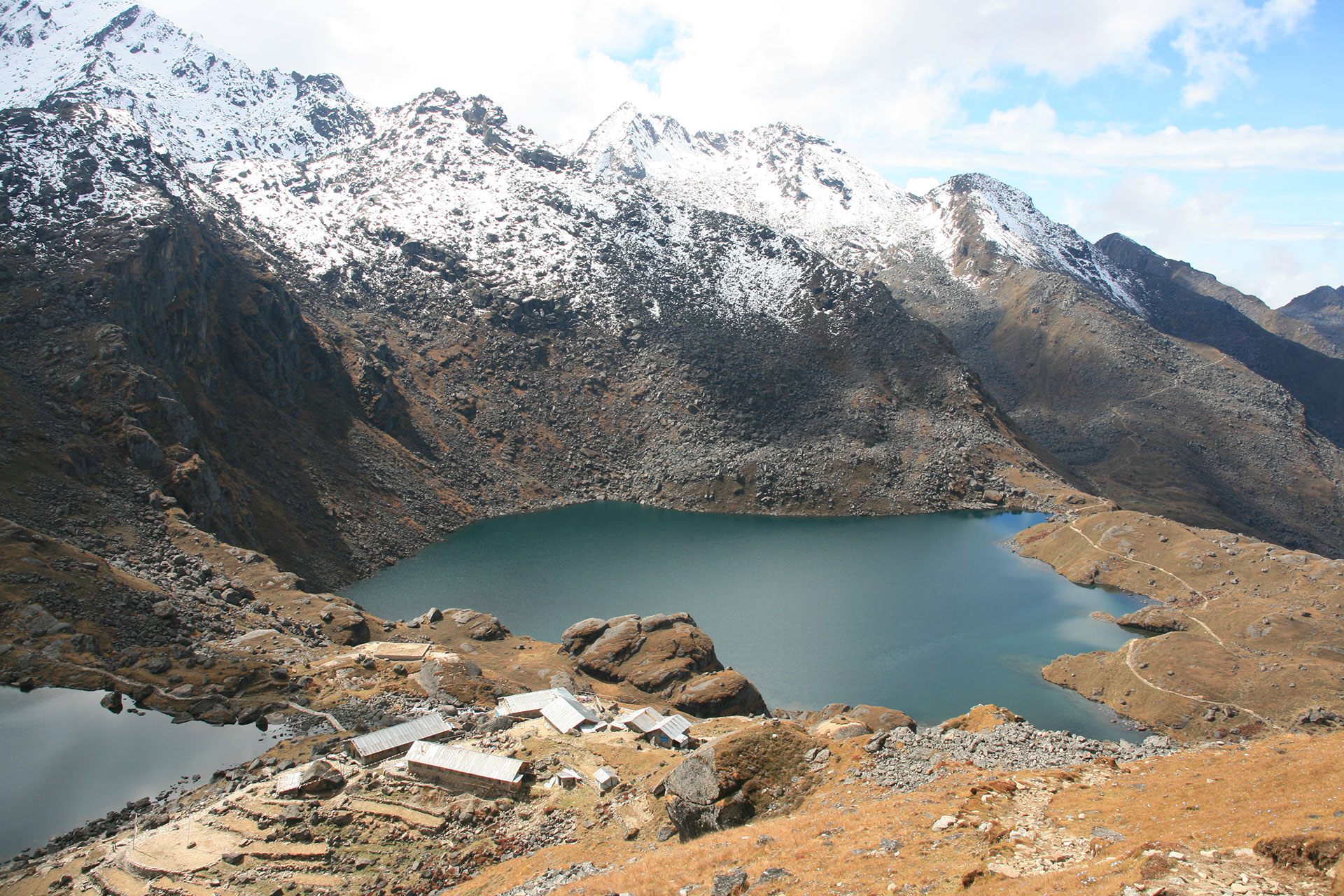
Finally, after approximately 5-6 hours of climbing, you'll reach the main Gosaikunda Lake at 4,380 meters. This is the most sacred and largest of the Gosaikunda lakes, revered by both Hindus and Buddhists. According to Hindu mythology, Lord Shiva created this lake by thrusting his trident into the mountain to obtain water to cool the poison he had swallowed to save the universe. The lake is believed to be directly connected to a pool at the Kumbeshwar Temple in Patan (Kathmandu Valley).
The Gosaikunda pilgrimage attracts thousands of Hindu and Buddhist devotees, especially during the Janai Purnima festival (full moon in August), when pilgrims come to bathe in the sacred waters seeking blessings and purification. Even outside festival times, the atmosphere is deeply spiritual, with prayer flags surrounding the lake, small shrines at the shore, and the profound sense of sacred geography.
The setting is spectacularly beautiful—the deep blue lake surrounded by rocky peaks, prayer flags fluttering in the wind, snow-capped mountains reflected in the still waters, and the vast open sky. The altitude and spiritual significance combine to create an overwhelming sense of being in a truly special place.
Check into your tea house—very basic lodges at this extreme altitude offering simple rooms, basic facilities, but warm hospitality. The lodges cluster near the main lake shore. After settling in, explore the lake area, circumambulate the lake clockwise (as pilgrims do), visit the small shrine, or simply sit by the shore absorbing the sacred atmosphere and mountain beauty.
Important: The altitude here is significant (4,380m). Move slowly, stay hydrated, and monitor for any altitude sickness symptoms. Some trekkers experience headaches or sleep difficulty at this elevation. Inform your guide immediately if you feel unwell.
The evening brings spectacular sunset on the surrounding peaks, with the changing light transforming the lake's colors. Dinner is simple but adequate—remember that all food and supplies are carried up by porters, so menus are limited but nourishing. Rest as well as possible tonight—tomorrow brings the challenging Laurebina Pass crossing.
Trekking Time: 5-6 hours
Altitude Gain: 1,050 meters
Accommodation: Very basic tea house at Gosaikunda
Meals: Breakfast, lunch, dinner
Trail Highlights: Sacred lakes, pilgrimage site, spectacular mountain scenery, spiritual atmosphere
Today is the most challenging day of the entire trek as you cross the Laurebina Pass (4,610m), the trek's highest point and a demanding high-altitude pass crossing. Wake very early (around 5:00-5:30 AM) for breakfast and an early start—crossing passes early in the day takes advantage of more stable weather conditions and harder snow/ice if present.
After a quick breakfast, begin the challenging ascent from Gosaikunda toward the pass. The trail climbs steeply through rocky terrain above the sacred lakes, gaining approximately 230 meters to reach the pass. The path is marked with cairns and prayer flags, winding through boulder fields and potentially snow-covered sections depending on the season.
The climb is physically demanding at this extreme altitude—the thin air (oxygen levels are roughly 60% of sea level) makes every step require effort. Move very slowly with frequent rest breaks, breathing deeply and steadily. Your guide sets an appropriate pace and provides encouragement. The early morning may bring freezing temperatures, so proper layering is essential.
After approximately 2-3 hours of strenuous climbing, reach the Laurebina Pass summit at 4,610 meters—the highest point of your entire trek and a significant achievement. The pass is marked with countless prayer flags strung between cairns, fluttering dramatically in the mountain wind and creating a powerful spiritual atmosphere.
The panoramic views from the pass are absolutely spectacular on clear days:
- Langtang Lirung, Ganesh Himal, Manaslu, and the Annapurna range visible in various directions
- Tibetan peaks to the north including Shishapangma on very clear days
- The Gosaikunda lakes spread below like jewels
- Endless ridges and valleys extending in every direction
Your guide conducts a small puja (blessing ceremony) at the pass, as is traditional—adding stones to cairns and offering prayers for safe passage. This is a moment for celebration, photographs, and appreciation of your accomplishment. Spend 15-20 minutes at the summit before beginning the descent.
The descent from Laurebina Pass is long and challenging in different ways—your knees and leg muscles work hard on the steep downhill sections. The trail descends rapidly through rocky terrain, following switchbacks down the southern side of the pass. The landscape remains harsh and alpine initially, with sparse vegetation and rocky slopes.
As you descend, the trail passes through increasingly vegetated terrain with alpine shrubs and eventually enters the upper reaches of forests. The path crosses several streams, winds through beautiful high-altitude meadows, and continues descending steadily.
Around midday, reach Phedi (3,740m), a small settlement with basic tea houses—an excellent lunch stop where you can rest tired legs and refuel. From Phedi, the trail continues descending through beautiful forests of rhododendron and fir, the landscape becoming progressively lusher as altitude decreases.
The afternoon brings you through magnificent forests draped with moss and lichens, creating an enchanted atmosphere. The trail alternates between forest paths and occasional ridgeline sections offering views. Despite the downward direction, the long distance makes this a tiring day.
Finally arrive at Ghopte (3,430m) by late afternoon—a small settlement of tea houses set in a forest clearing on a high ridge. The village serves primarily as a trekking stop rather than a permanent settlement.
Check into your tea house—basic but adequate lodges offering warm shelter after the demanding day. The rooms are simple with twin beds and shared bathrooms, but the warm dining room with wood stove provides perfect comfort.
After settling in, rest your tired legs, enjoy hot tea, and celebrate your successful pass crossing—one of the trek's major accomplishments. The evening brings well-deserved dinner and early rest after today's long, challenging day.
Trekking Time: 7-8 hours
Altitude: 4,610m (pass), descending to 3,430m
Altitude Change: +230m, then -1,180m descent
Accommodation: Tea house at Ghopte
Meals: Breakfast, lunch, dinner
Trail Highlights: Laurebina Pass summit, spectacular panoramic views, high-altitude crossing, dramatic descent
After breakfast, continue your descent toward the Kathmandu Valley, leaving the high-altitude zones behind. Today's trek follows a spectacular ridge route offering constantly changing perspectives and beautiful landscapes.
The trail initially climbs slightly from Ghopte before following an undulating ridge path that alternates between short ascents and longer descents. The route traverses through beautiful mixed forests of rhododendron, oak, and pine—particularly stunning during spring bloom season when rhododendrons create explosions of color along the entire ridge.
The ridge walk offers excellent views in both directions when clear—glimpses of the Himalayan peaks you've visited behind you (north) and valleys descending toward Kathmandu ahead (south). The trail passes through several small settlements and herders' shelters, each offering potential rest stops.
Around midday, reach Tharepati (3,490m), a significant junction settlement with several tea houses. This village sits at a three-way trail junction connecting routes from Gosaikunda, Helambu, and Kathmandu Valley—a strategic location making it an important trekking hub. Stop here for lunch and a proper rest.
From Tharepati, the trail descends more consistently through increasingly lush forests. The vegetation becomes progressively denser and more diverse as you lose altitude, with the ecosystem transitioning from alpine to temperate zone forests.
The afternoon brings you through beautiful forest landscapes with occasional clearings offering views. The trail is well-maintained with stone steps in steeper sections, making the descent comfortable. As you continue losing altitude, you'll notice the air becoming noticeably thicker and warmer—breathing becomes easier and energy levels increase.
Pass through the small settlement of Mangengoth (3,285m) before the final descent to Kutumsang (2,470m), a pleasant Tamang village spread across terraced hillsides. The village features traditional stone houses, terraced farmland growing corn, millet, and vegetables, and warm local hospitality.
Check into your tea house—comfortable lodges offering better facilities than the higher-altitude stops, often with attached bathrooms, hot showers (sometimes), and cozy dining areas. The lower elevation means more comfortable sleeping conditions.
After settling in, explore the village, interact with local Tamang families, or simply rest and enjoy the warmer temperatures. The village atmosphere is peaceful and authentic, offering insights into traditional mountain agricultural life.
Evening brings sunset views across the valleys if weather permits. Dinner features hearty Nepali food with dal bhat and other options. Rest well tonight—tomorrow brings you closer to the trek's conclusion.
Trekking Time: 6-7 hours
Altitude Loss: 960 meters
Accommodation: Tea house in Kutumsang
Meals: Breakfast, lunch, dinner
Trail Highlights: Ridge walking, forest descent, Tamang villages, diverse ecosystems
Your final trekking day brings you from the mountains back to the Kathmandu Valley, completing your remarkable Langtang Gosaikunda journey. After breakfast, begin the long descent through beautiful middle-hill landscapes.
The trail descends steadily through terraced farmland and forests, passing through several traditional Tamang and Brahmin/Chhetri villages. The landscape becomes progressively more populated and cultivated as you approach the valley, with extensive terracing demonstrating centuries of mountain agriculture.
The morning brings you through Chisapani (2,165m), a popular viewpoint village known for Himalayan sunrise views. Continue descending through increasingly lush forests of oak, rhododendron, and pine. The well-maintained trail alternates between forest paths and sections passing through villages and farmland.
Around midday, pass through Mulkharka and Borlang Bhanjyang before reaching the Shivapuri National Park boundary. The trail enters the protected forest area surrounding Kathmandu Valley's northern watershed.
The afternoon brings sustained descent through beautiful forests within the national park, eventually reaching Sundarijal (1,350m)—a small town at the valley's northern edge, famous for its hydroelectric plant and water supply system serving Kathmandu. The town marks the end of your trekking journey, with roads connecting to Kathmandu just 16 kilometers away.
Arrive at Sundarijal by early-to-mid afternoon where your transport awaits. Your guide conducts a small farewell ceremony, thanking the mountains for safe passage. This is also the time to tip your trekking guide and any porters—tips are customary and very important to their livelihoods (your guide can advise on appropriate amounts).
Drive to Kathmandu (45-60 minutes): Board your private vehicle for the drive back to Kathmandu. The road winds down through the valley's northern suburbs, offering perspectives on the urban sprawl surrounding the ancient capital. The contrast between the peaceful mountains you've been trekking and the busy city is striking and somewhat jarring.
Arrive at your Kathmandu hotel by late afternoon. Check in, enjoy your first hot shower in days, and begin readjusting to city life after your mountain adventure. The evening is free to rest, organize gear, perhaps enjoy a celebration dinner at one of Kathmandu's excellent restaurants, or simply reflect on your incredible journey through the Langtang region and Gosaikunda.
Your Langtang Gosaikunda trek is now complete—12 days of extraordinary mountain adventure combining dramatic Himalayan landscapes, rich Tamang culture, sacred pilgrimage sites, challenging high passes, and some of Nepal's most spectacular scenery. The memories, photographs, and experiences from this journey will last a lifetime.
Trekking Time: 5-6 hours
Drive Time: 45-60 minutes
Altitude Loss: 1,120 meters
Accommodation: Hotel in Kathmandu (not included)
Meals: Breakfast, lunch (dinner not included)
Trail Highlights: Forest descent, Shivapuri National Park, journey completion
Includes/Excludes
Includes
- All ground transportation (Kathmandu-Syabrubesi, Sundarijal-Kathmandu)
- Experienced, licensed trekking guide
- Porter service (1 porter for every 2 trekkers)
- Tea house accommodation throughout the trek (twin-sharing basis)
- Three meals daily (breakfast, lunch, dinner) during the trek
- All necessary trekking permits (TIMS, Langtang National Park permit)
- First aid kit and emergency oxygen cylinder
- Government taxes and service charges
Excludes
- International airfare to/from Nepal
- Nepal entry visa fees
- Kathmandu hotel accommodation (before and after trek)
- Meals in Kathmandu
- Drinks (tea, coffee, soft drinks, alcohol) during the trek
- Hot showers and WiFi charges at tea houses
- Travel insurance (mandatory)
- Personal trekking equipment
- Tips for guide and porters
- Emergency evacuation costs
- Personal expenses
Additional Info
Packing Essentials:
- Footwear: Broken-in trekking boots, camp shoes, warm socks
- Clothing: Layering system, down jacket, rain gear, thermal underwear, trekking pants, gloves, warm hat
- Gear: Sleeping bag (warm rating), trekking poles, headlamp, sunglasses, daypack
- Accessories: Sunscreen (high SPF), water purification, first aid kit, toiletries
- Documents: Passport copies, permits, insurance information
Best Time to Trek:
- Spring (March-May): Excellent visibility, rhododendron blooms, moderate temperatures
- Autumn (September-November): Crystal-clear views, stable weather, perfect temperatures
- Winter (December-February): Possible but very cold, snow on high passes
- Monsoon (June-August): Not recommended—heavy rain, leeches, obscured views
Important Notes:
- Altitude acclimatization is crucial for this trek
- Travel insurance covering high-altitude trekking (up to 5,000m) is mandatory
- Physical fitness preparation recommended
- Respect local culture and Buddhist/Hindu sacred sites
- Practice Leave No Trace principles
- The 2015 earthquake affected this region—rebuilding has been completed, but remember the resilience of local communities
Why Choose Discover Himalayan Adventure
As a new emerging company, Discover Himalayan Adventure Pvt. Ltd. brings fresh energy, passion, and commitment to creating exceptional trekking experiences while supporting local communities.
Our Advantages:
Local Expertise: Our guides are experienced Langtang specialists with intimate knowledge of trails, culture, wildlife, and the region’s history. Many of our team members are from Langtang communities themselves.
Safety First: Comprehensive training, first aid certification, altitude illness recognition, emergency protocols, and quality equipment ensure your safety throughout the trek.
Fair Practices: We pay guides and porters fair wages exceeding industry standards, provide proper equipment and insurance, and ensure safe working conditions. When you trek with us, you support ethical tourism.
Community Support: We contribute to Langtang rebuilding efforts, partner with local lodges and businesses, and ensure your spending benefits communities directly.
Personalized Service: Small group sizes, flexible itineraries, attention to individual needs, and genuine care for your experience set us apart.
Value: Competitive pricing without compromising quality or safety. Transparent costs with no hidden fees.
Sustainability: Leave No Trace principles, environmental awareness, cultural sensitivity, and responsible tourism practices guide all our operations.
Contact Us – Book Your Langtang Valley Trek
Ready to explore the beautiful Langtang Valley?
Phone/WhatsApp: +977-9863209797
Direct contact for immediate assistance and booking
Email: info@discoverhimalayan.com
Detailed responses within 24 hours
Website: www.discoverhimalayan.com
Complete information and online booking
Social Media:
Facebook: facebook.com/discoverhimalayan
Instagram: @discoverhimalayan
Pinterest: pinterest.com/discoverhimalayan
Whether you’re planning your first Himalayan trek, seeking pristine beauty away from crowds, wanting to support earthquake recovery communities, or simply desiring an authentic mountain experience, we’re here to help.
Contact us today to discuss your dates, ask questions, and start planning your Langtang Valley adventure. Our team provides personalized assistance, answers all inquiries, and ensures your trek exceeds expectations.
Your Langtang journey awaits—spectacular mountains, warm hospitality, and unforgettable memories in Nepal’s hidden valley!